Tag Archives: weather

Why Have Global Weather Patters Gone Completely And Totally Nuts This Winter? | End Of The American Dream

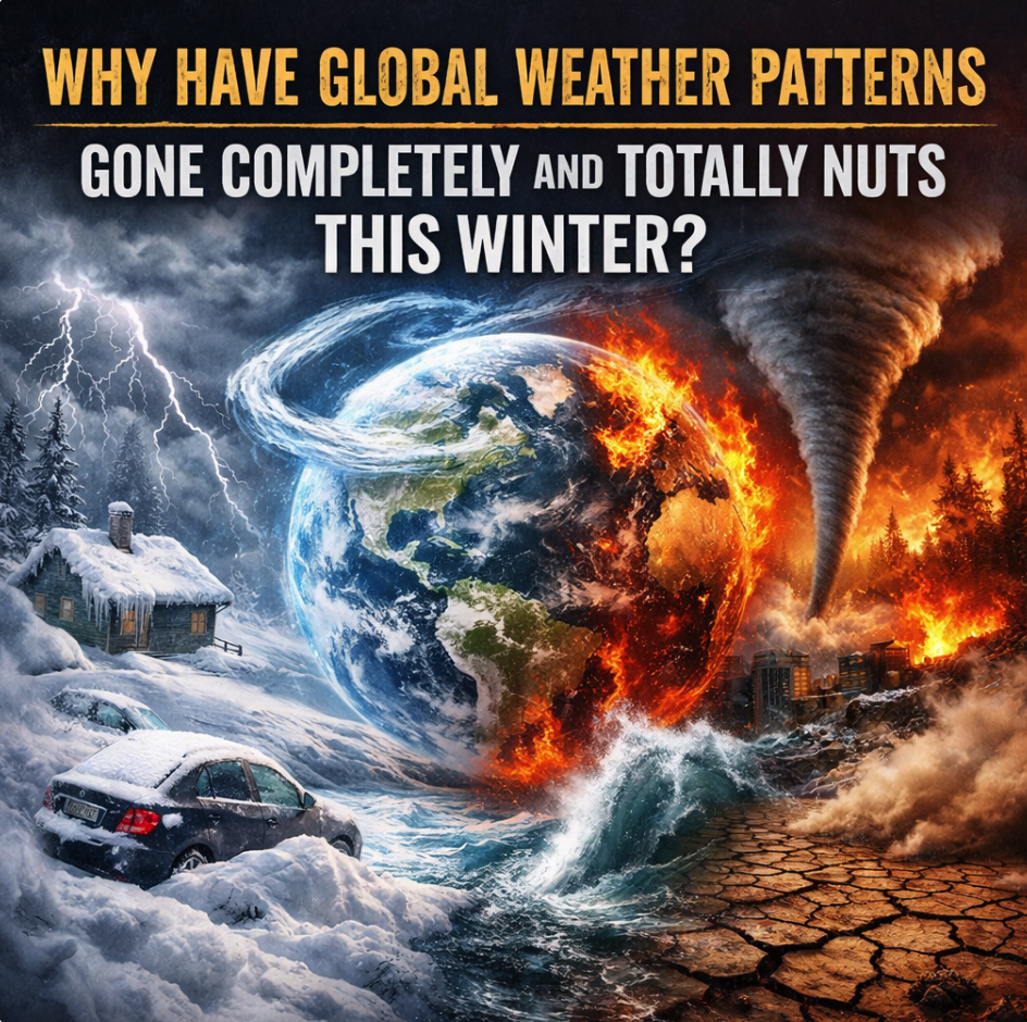
You may have noticed that this has been a really strange winter. In some areas there has been far less snow than usual, while in other areas people are literally being buried in their homes by mountains of snow. In some areas it has been much colder than average, while in other areas record high temperatures are being shattered. I have been writing about how global weather patterns have been going nuts for a long time, and initially there were some skeptics that just weren’t buying it. They thought that I was exaggerating, and they were convinced that conditions would “return to normal” eventually. But now even the New York Times is talking about how “weird” the weather has been this winter…

The weather has been a bit weird across the United States this winter. As historic amounts of snow fell in the Carolinas and bitter cold gripped practically everywhere else east of the Rockies, some of the western states have basked in high temperatures more typical of late spring than the dead of winter.

Perhaps no other contrast tells this story better than the fact that, since the start of the year, Florida has recorded more snow than Salt Lake City.

Read the last sentence of that quote from the New York Times again.

Florida is not supposed to get more snow than Salt Lake City.

That is crazy.

We have never seen anything like this before, and it is being caused by “a weather pattern that settled into place around the middle of January and hasn’t budged for weeks”…

These two extremes are the result of a weather pattern that settled into place around the middle of January and hasn’t budged for weeks. It’s kept the western United States unusually dry, depriving ski resorts and water reservoirs of their much-needed snowpacks. And it’s plunged the eastern two-thirds of the country into bitterly cold temperatures that have lingered for weeks.

This same pattern that brought 80-degree temperatures to Los Angeles this week sent ice, freezing temperatures and power outages to Tennessee, Mississippi and Louisiana late last month. It has given Phoenix its warmest winter ever in records going back to 1885 and delivered a rare snowfall to Wilmington, N.C., last weekend.

The worst snow drought in history threatens to cause a major crisis in the western third of the nation.

At this point, the amount of snow cover is about a third of what it normally should be…

A record snow drought with unprecedented heat is hitting most of the American West, depleting future water supplies, making it more vulnerable to wildfires and hurting winter tourism and recreation.

Scientists say snow cover and snow depth are both at the lowest levels they’ve seen in decades, while at least 67 Western weather stations have measured their warmest December through early February on record. Normal snow cover this time of year should be about 460,000 square miles — about the size of California, Utah, Idaho and Montana — but this year it’s only California-sized, about 155,000 square miles, according to the National Snow and Ice Data Center.

The snowpack — measured by how much water is trapped inside — in Oregon is not only record low, but 30% lower than the previous record, said Jason Gerlich, regional drought early warning system coordinator for the National Oceanic and Atmospheric Administration.

This is going to have enormous implications for farmers in the region throughout the rest of this year.

Unfortunately, high temperatures continue to persist.

On Sunday, the temperature in Denver was 22 degrees above normal.

Hopefully colder temperatures will arrive soon, because there is not much time left before spring arrives.

Of course it isn’t just the United States that has been experiencing bizarre weather.

Last month, Toronto was slammed by “the largest snowfall in the city’s history”

Toronto is beginning to dig itself out from the largest snowfall in the city’s history, a process which officials say is likely to take “several days”.

Some parts of Canada’s largest city were buried under nearly 60cm (about 23in) of snow and more than 500 flights were cancelled Sunday after Toronto’s main airport was snowed in.

More than 88.2cm of snow have fallen at Pearson international airport this month, marking the snowiest January and snowiest month since records began in 1937.

Toronto is not supposed to get 2 feet of snow.

But it did.

On the other side of the world, Moscow recently received “the largest snowfall in more than 200 years”

Russia’s capital Moscow has seen the largest snowfall in more than 200 years this month, Moscow State University meteorologists said on Thursday.

Images from the city of around 13 million people showed residents struggling to make their way through heavy piles of snow on the streets in its central district.

Commuter trains in the Moscow area were delayed and cars were stuck in long traffic jams on Thursday evening.

That was bad, but the record snowfall that hit the Kamchatka peninsula last month was even worse

Meteorologists say the level of snowfall in Kamchatka since early January has not been seen since recordkeeping began half a century ago.

In December, Petropavlovsk-Kamchatsky saw triple the monthly average of snowfall, while Jan. 1-16 saw around 150% more than the monthly average for that period. The average height of snow in the city reached 170 centimeters (5.5 feet), with drifts exceeding 2.5 meters (8 feet) in certain neighborhoods.

“The last time we saw something like this was over 50 years ago, in the early 1970s,” said Vera Polyakova, head of Kamchatka’s Hydrometeorology Center. “These conditions are exceptionally rare as far as modern observations go.”

By now, I am sure that most of you have seen images of the absolutely massive snow drifts in Kamchatka.

But the record-breaking snowfall that we witnessed in Japan earlier this month was even crazier.

One 91-year-old woman was actually found dead under 118 inches of snow

Record-breaking snowfall in Japan has been blamed for 30 deaths in the past two weeks, including a 91-year-old woman found buried under 300cm (118 inches) of snow outside her home, officials said.

The heavy snowfall prompted the government of Prime Minister Sanae Takaichi to order the deployment of troops on Tuesday to help in affected areas, according to the Japanese national television NHK.

Are you starting to see what I am talking about?

The weather has been crazy all over the world.

In India, temperatures have been far lower than normal

The India Meteorological Department (IMD) and media reports show a cold condition affecting northern and central India, with unusually low temperatures and dense fog disrupting daily life. Delhi recorded one of its coldest January mornings in recent years, with temperatures dipping to 3.2°C on 13 January.

Cities across Haryana, Punjab, and Rajasthan recorded near-freezing temperatures, while Gurugram, in the National Capital Region, registered a chilling 0.6°C, among its lowest readings in close to 50 years. Parts of northern India remained colder than several Himalayan hill towns.

Gujarat, where winters are usually mild, has been experiencing a rare cold spell, with night temperatures in Saurashtra and the central and southern regions dropping into the single digits. Minimum temperature below normal by 2-3°C was recorded at many places in Karnataka too.

Meanwhile, temperatures have been crazy hot all over the southern hemisphere

From Argentina to Australia to South Africa, record heat and raging wildfires are rampaging through the Southern Hemisphere at the start of 2026, with scientists predicting that even more extreme temperatures could lie ahead – and possibly another global annual high – after three of the hottest years on record.

In January, a record-setting heat dome enveloped Australia, sending temperatures near 50 degrees C (122 degrees F) while heat and catastrophic wildfires gripped parts of South America, setting remote parts of Argentina’s Patagonia ablaze and killing 21 people in coastal towns in Chile. In addition, South Africa has been experiencing its worst wildfires in years.

We don’t hear much about the wildfires in the southern hemisphere here in the United States, but they have been really bad.

And the scorching temperatures that we have been witnessing have been nothing short of eye-popping.

In Australia, a number of communities have recently recorded high temperatures in excess of 120 degrees Fahrenheit

According to BoM, the hottest temperatures of January 2026 were measured in two places in South Australia: in the town of Andamooka on the 29th and at the Port Augusta airport on the 30th, where temperatures reached 50.0°C (122.0°F). In both New South Wales and Victoria, the month’s hottest day was on the 27th, when temperatures reached 49.7°C (121.5°F) at a station in Pooncarie and 48.9°C (120.0°F) at stations in Walpeup and Hopetoun.

When the giant ball of fire that our planet revolves around becomes more active, global weather patterns tend to be more volatile.

Needless to say, the giant ball of fire that our planet revolves around has been very active lately.

But if you think that things are bad now, just wait, because what we have been through so far is just the beginning.

Most people don’t seem to realize this yet, but we really have entered one of the most apocalyptic chapters in human history.

Natural disasters are going to continue to increase in frequency and intensity, and global weather patterns are not going to “return to normal” any time soon.

Michael’s new book entitled “10 Prophetic Events That Are Coming Next” is available in paperback and for the Kindle on Amazon.com, and you can subscribe to his Substack newsletter at michaeltsnyder.substack.com.

About the Author: Michael Snyder’s new book entitled “10 Prophetic Events That Are Coming Next” is available in paperback and for the Kindle on Amazon.com. He has also written nine other books that are available on Amazon.com including “Chaos”“End Times”“7 Year Apocalypse”“Lost Prophecies Of The Future Of America”“The Beginning Of The End”, and “Living A Life That Really Matters”.  When you purchase any of Michael’s books you help to support the work that he is doing.  You can also get his articles by email as soon as he publishes them by subscribing to his Substack newsletter.  Michael has published thousands of articles on The Economic Collapse BlogEnd Of The American Dream and The Most Important News, and he always freely and happily allows others to republish those articles on their own websites.  These are such troubled times, and people need hope.  John 3:16 tells us about the hope that God has given us through Jesus Christ: “For God so loved the world, that he gave his only begotten Son, that whosoever believeth in him should not perish, but have everlasting life.”  If you have not already done so, we strongly urge you to invite Jesus Christ to be your Lord and Savior today.

The post Why Have Global Weather Patters Gone Completely And Totally Nuts This Winter? appeared first on End Of The American Dream.

A Christmas Message? A “Bomb Cyclone” That Will Slam Into California On Christmas Eve Will Cause 100 MPH Winds And Up To 120 Inches Of Snow | End Of The American Dream

To say that some parts of California are going to experience a “white Christmas” this year would be an enormous understatement. Some of the numbers that I am going to share with you in this article are difficult to believe, but I did not come up with any of them. Respected meteorologists are issuing forecasts that seem like they have been pulled directly out of a Hollywood disaster movie. How much crazier will things have to get before people start to realize that what we are experiencing is not even close to normal?

Last week, I wrote an article about what has been happening in the Northwest.  Trillions of gallons of rain have fallen, flooding has been so bad that some roads will be closed for months, and at least 9 different states experienced wind speeds of at least 100 mph.

If all of that wasn’t enough, now we are being told that a “bomb cyclone” is going to hit California on Christmas Eve

A strong storm system known as a bomb cyclone is lining up to slam the U.S. on Christmas Eve, possibly complicating holiday travel and bringing gusty winds that could cause power outages.

The forecast comes as much of California remains under some form of National Weather Service (NWS) alert on Monday as an atmospheric river inundates the state with heavy rain and mountain snow. Conditions are expected to worsen as the week progresses, with a bomb cyclone set to slam the West Coast on Christmas Eve.

Some people may be tempted to think that we are sensationalizing things when we say that a “bomb cyclone” is coming.

But that is not the case at all.

It is a very technical meteorological term that only applies under very strict conditions

Bomb cyclone is a meteorological term for a storm undergoing bombogenesis. This occurs when a storm’s central pressure drops at least 24 millibars within 24 hours. The lower the pressure, the more powerful the storm becomes.

This is the first “bomb cyclone” to hit California this year.

And one expert is warning that the forecast just “keeps getting worse”

And the storm forecast just “keeps getting worse,” according to KTLA weather anchor Mark Kriski.

Major travel disruptions, mudslides, flooding and other safety hazards are expected to come at one of the busiest travel times of the year, the National Weather Service said, urging residents to prepare.

In addition to all that, we are being told that we could even see “a tornado or two” if conditions are just right.

But things will get really crazy once the storm reaches the mountains

  • Greater Lake Tahoe communities may see up to 2 feet of snow at lake level and 4 feet above 7,000 feet, with winds reaching 100 mph from Tuesday night through Friday morning.
  • A powerful winter storm is forecast to blanket California’s Sierra Nevada with up to five feet of snow and winds nearing 55 mph from Tuesday evening through Friday, creating hazardous holiday travel conditions and prompting a National Weather Service warning.
  • Mono County could see 10–20 inches of snow, with higher elevations reaching 4 feet and winds up to 100 mph.
  • Yosemite National Park may be buried under as much as 8 feet of snow, with winds near 50 mph lasting through Friday.
  • Siskiyou County, including Snowman’s Summit, is expected to receive 1–3 feet of snow and winds up to 60 mph; elevations above 4,500 feet could see 5 feet of snow.

Wow.

I can’t even imagine what conditions will be like with that much wind and that much snow.

If you live in those areas, please do not attempt to travel anywhere.

According to AccuWeather Chief On-Air Meteorologist Bernie Rayno, the peaks of the Sierra Nevada mountains are probably going to get “at least 10 feet of snow this week”

“We’re probably looking at, at least 10 feet of snow this week over the ridges and peaks of the Sierra Nevada, which is what they need from an upcoming summer water demand standpoint,” AccuWeather Chief On-Air Meteorologist Bernie Rayno said.

10 feet equals 120 inches.

I have never lived anywhere that has gotten 120 inches of snow in a week.

Have you?

Needless to say, conditions will be much different in the major cities, but it is being projected that Sacramento, Los Angeles and San Francisco could all get “a month’s worth of rainfall this upcoming week”

Atmospheric rivers continue to soak the West, bringing heavy rainfall, gusty winds and mountain snowfall. The latest event is ramping up for Northern and Central California this weekend and is expected to last into the week. Flood watches are in effect through the next several days, where widespread rainfall of 5 to 8 inches is possible through Thursday and isolated totals could near a foot. Cities like Sacramento, Los Angeles and San Francisco could see a month’s worth of rainfall this upcoming week.

That is not good news at all.

Some areas of Northern California are already reeling from widespread flooding that was caused by the last atmospheric river

The most recent atmospheric river dumped anywhere from 3 to 12 inches of rain in Northern California’s coastal ranges and Sierra foothills last weekend.

That lead to just over 40 reports of flooding, 20 reports of landslides and another 16 reports of wind damage in the state from Saturday night through early Monday morning. Among the most serious flash flooding occurred in and near Redding, in far Northern California, where water rescues occurred.

For the last several years, the United States has been getting repeatedly pummeled by one “billion dollar disaster” after another.

But most people just think that conditions will “return to normal” eventually.

I don’t want to rain on anyone’s parade, but that simply isn’t going to happen.

We really do live at a time when global weather patterns are going completely nuts.

And what we have been through so far is nothing compared to what is eventually coming.

The “bomb cyclone” that is going to hit California on Christmas Eve is another wake up call.

The state will be hammered by very heavy rain, extremely high winds, and several feet of mountain snow.

But no matter how many wake up calls we get, most of the population just continues to sleep.

That is really unfortunate, because the clock is ticking…

Michael’s new book entitled “10 Prophetic Events That Are Coming Next” is available in paperback and for the Kindle on Amazon.com, and you can subscribe to his Substack newsletter at michaeltsnyder.substack.com.

About the Author: Michael Snyder’s new book entitled “10 Prophetic Events That Are Coming Next” is available in paperback and for the Kindle on Amazon.com. He has also written nine other books that are available on Amazon.com including “Chaos”“End Times”“7 Year Apocalypse”“Lost Prophecies Of The Future Of America”“The Beginning Of The End”, and “Living A Life That Really Matters”.  When you purchase any of Michael’s books you help to support the work that he is doing.  You can also get his articles by email as soon as he publishes them by subscribing to his Substack newsletter.  Michael has published thousands of articles on The Economic Collapse BlogEnd Of The American Dream and The Most Important News, and he always freely and happily allows others to republish those articles on their own websites.  These are such troubled times, and people need hope.  John 3:16 tells us about the hope that God has given us through Jesus Christ: “For God so loved the world, that he gave his only begotten Son, that whosoever believeth in him should not perish, but have everlasting life.”  If you have not already done so, we strongly urge you to invite Jesus Christ to be your Lord and Savior today.

The post A Christmas Message? A “Bomb Cyclone” That Will Slam Into California On Christmas Eve Will Cause 100 MPH Winds And Up To 120 Inches Of Snow appeared first on End Of The American Dream.

The West Coast Is Being Absolutely Pummeled By Trillions Of Gallons Of Rain, Wind Speeds Of Up To 144 MPH, And Flooding That Will Close Roads For Months | The Economic Collapse

The slow-motion disaster that we are witnessing on the west coast is unlike anything we have ever seen before.  A series of atmospheric rivers has already dumped trillions of gallons of water on the region, and trillions of gallons of additional water will fall before the end of the year.  This has caused some rivers to rise to the highest levels that we have ever seen.  Meanwhile, some areas in the Northwest have been repeatedly pummeled by extremely high winds.  As you will see below, some of the wind speeds that have been recorded are difficult to believe.  For a long time I have been warning my readers that weather patterns have been going nuts all over the globe, but of course many people will never be convinced until it actually happens where they live.  For tens of millions of Americans that live along the west coast, a wake up call has finally arrived.

According to the Weather Channel, the parade of storms that we have been witnessing will continue to roll on into next week…

A parade of Pacific storms accompanied by atmospheric rivers will continue to march into the West Coast into Christmas week, spreading the threat of heavy rain from already flooded areas of western Washington to Oregon and California.

To say it’s been a terrible stretch of weather in parts of the West has been an understatement.

The last sentence in that quote made me smile.

Yes, “a terrible stretch of weather” would most certainly be an understatement

First, record flooding hit parts of western Washington. Then, as flood-ravaged areas were recovering, a powerhouse windstorm blasted much of the Northwest and Rockies Wednesday, with winds clocked up to 144 mph and over 160 reports of wind damage in Washington, Oregon, Idaho, Montana, Wyoming and Colorado.

I can’t recall a windstorm of this magnitude ever hitting the Pacific Northwest in modern times.

It is being reported that at least nine different states experienced wind speeds of over 100 mph…

High winds slammed the Pacific Northwest and Rockies Wednesday and Wednesday night, cutting power to three-quarters of a million customers at peak, according to PowerOutage.US. That number was down to 325,000 as of Thursday morning.

The highest wind gusts in the region were on mountain tops — 144 mph at Mount Coffin, Wyoming, 142 mph at Coldwater Ridge, Washington, and 138 mph at Mount Hood, Oregon. Winds gusted over 100 mph on mountaintops in at least nine different states.

Now that storm has moved into the middle of the country, and blizzard conditions are expected in much of the Northern Plains

“Wind gusts of 80+ mph, several feet of mountain snow, and blizzard conditions are in the forecast for the northern and western U.S. today and tomorrow,” the forecast said.

A map included with the post on X showed that while the entirety of the Northern Plains was expected to see some impacts from the storm, some states will likely be hit by widespread major impacts. These include Montana, Wyoming, North Dakota, Colorado and Idaho.

But it is the west coast that has been getting hit harder than anyone else.

Some areas of Washington state have already had about 2 feet of rain, and more rain is on the way.

Yes, Washington state always gets rain, but this is truly unusual.

If you can believe it, approximately 5 trillion gallons of water fell on the state in just a 7 day period…

Warm water and air and unusual weather conditions tracing back as far as tropical cyclone flooding in Indonesia helped supercharge stubborn atmospheric rivers that have drenched Washington state with almost 5 trillion gallons (19 trillion liters) of rain in the past seven days, threatening record flood levels, meteorologists said.

The Skagit River rose to the highest level ever recored.

So did the Snohomish River.

Needless to say, many other bodies of water flooded as well.

According to Governor Bob Ferguson, a 49 mile stretch of US Highway 2 will be closed for months as a result of the flooding…

Massive flooding conditions persist across western Washington as another round of heavy rain and wind targets the region, adding to the damage from last week’s historic flooding and raising renewed concerns about vulnerable levees, landslide risks, and long-term transportation disruptions.

On Tuesday, Gov. Bob Ferguson said a 49-mile stretch of US Highway 2 between Skykomish and Leavenworth will be closed for months after floodwaters and mudslides heavily damaged the roadway.

Unfortunately, more rain is in the forecast.

In fact, it is being projected that some areas of western Oregon could get more than 10 inches of rain from this next storm…

A general 4-8 inches of rain is forecast to fall on western Oregon, with slightly less in the Interstate 5 corridor near Portland. From 8-12 inches of rain with an AccuWeather Local StormMax™ of 16 inches is projected for the western slopes of the Oregon Cascades.

This amount of rain will be enough to unleash moderate to major flooding along both small streams and rivers in western Oregon. A few locations may experience crests close to record levels, such as in the Portland area. Motorists should be prepared for areas of high water and road washouts. Mudslides are also a danger with the storm.

Meanwhile, meteorologist Ryan Maue is telling us that the Sierra Mountains in California could see up to 30 inches of precipitation from the “firehose of moisture” that is approaching…

California is looking at historic precipitation from onslaught of atmospheric rivers in next 10-days.

Could be 20″ or 30″ mostly rain in the Sierra from “firehose of moisture” directed right at coast with strong jet stream.

This going to be really bad.

He isn’t exaggerating.

It certainly looks like the next couple of weeks will be really bad.

If you live in an area along the west coast that is prone to flooding, you should be doing what you can to get prepared.

Of course this is just the beginning.

Global weather patterns have been getting increasingly unstable for quite a while, and I am entirely convinced that what is coming in the years ahead will be much worse than anything that we are experiencing now.

We really are living in extremely chaotic times, and the insane weather that we are currently witnessing is just one element of “the perfect storm” that is now upon us.

Michael’s new book entitled “10 Prophetic Events That Are Coming Next” is available in paperback and for the Kindle on Amazon.com, and you can subscribe to his Substack newsletter at michaeltsnyder.substack.com.

About the Author: Michael Snyder’s new book entitled “10 Prophetic Events That Are Coming Next” is available in paperback and for the Kindle on Amazon.com.  He has also written nine other books that are available on Amazon.com including “Chaos”“End Times”“7 Year Apocalypse”“Lost Prophecies Of The Future Of America”“The Beginning Of The End”, and “Living A Life That Really Matters”.  When you purchase any of Michael’s books you help to support the work that he is doing.  You can also get his articles by email as soon as he publishes them by subscribing to his Substack newsletter.  Michael has published thousands of articles on The Economic Collapse BlogEnd Of The American Dream and The Most Important News, and he always freely and happily allows others to republish those articles on their own websites.  These are such troubled times, and people need hope.  John 3:16 tells us about the hope that God has given us through Jesus Christ: “For God so loved the world, that he gave his only begotten Son, that whosoever believeth in him should not perish, but have everlasting life.”  If you have not already done so, we strongly urge you to invite Jesus Christ to be your Lord and Savior today.

The post The West Coast Is Being Absolutely Pummeled By Trillions Of Gallons Of Rain, Wind Speeds Of Up To 144 MPH, And Flooding That Will Close Roads For Months appeared first on The Economic Collapse.

The “Year Of The Flood” Continues – The U.S. Was Just Hit By 4 More Catastrophic Flooding Events In Just 48 Hours | The Economic Collapse

How much flooding is it going to take before people realize that something truly out of the ordinary is going on?  This month, we have been hammered by “1,000 year storms” and “1,000 year floods” over and over again.  In a previous article, I documented 13 catastrophic flooding events in just 13 days.  Unfortunately, that wasn’t the end of it.  In fact, we were just hit by 4 more catastrophic flooding events in just 48 hours.  In the entire history of our country, we have never seen anything like we have witnessed this month.  Every region of the U.S. has been repeatedly hit by major flooding, and there seems to be no end in sight.

On Friday, 6 inches of rain fell on one area of Chicago in less than two hours, and as a result there was tremendous flooding

Severe thunderstorms brought flash flooding to the Chicago metropolitan area on Friday afternoon, July 25, with some locations receiving over 150 mm (6 inches) of rainfall in under two hours.

Chicago Midway International Airport recorded 38 mm (1.5 inches) of rain in just 37 minutes. Within 90 minutes, the total had reached 70 mm (2.77 inches). A ground stop was issued at Midway, and both Midway and O’Hare International Airports experienced delays to inbound and outbound flights.

In Bridgeview, more than 150 mm (6 inches) of rain fell in less than two hours, overwhelming storm drains and flooding streets. Located in one of the lowest elevation zones in the Chicago area, Bridgeview is particularly vulnerable to flooding.

On Saturday, 10 inches of rain caused historic flooding in Lincoln County, Missouri

Lincoln County is in a state of emergency following major flash floods overnight in and around the city of Elsberry. The Lincoln County Emergency Management Agency reports the northern part of Elsberry received over 10 inches of rain overnight.

The flooding in Lincoln County was so bad that rescuers in boats were going door to door to pull people out of their homes…

Severe flooding has hit Lincoln County, Missouri, particularly affecting the town of Elsberry, where emergency services have conducted multiple water rescues.

Quentin Laws, the Lincoln County Emergency Manager, stated, “We have multiple boat rescues going door to door.” He emphasized the importance of residents staying off the roads.

The flooding began around 11 p.m. Saturday night, with torrential rain causing flash floods in the area. Laws said the hardest hit area was between 2nd and 7th Street on the south side of Elsberry basically along Highway 79 and near the BNSF railroad. It’s a low lying area but doesn’t flood very often according to local officials.

Also on Saturday, violent flooding hit Ruidoso, New Mexico for the second time this month.  In this instance, the rapidly moving floodwaters actually picked up an entire mobile home and swept it away

Afternoon thunderstorms brought new flash floods to Ruidoso, New Mexico, where residents are still reeling from deadly floods at the beginning of July. One woman standing on her back porch recorded dramatic video of a mobile home being swept away in the muddy rapids.

New Mexico is not normally known for flooding.

But now everything is changing.

On top of everything else, several inches of rain within just a couple of hours caused widespread flash floods in three Ohio counties on Saturday night

Thunderstorms that swept through central Ohio on Saturday night prompted flash flood warnings in parts of Franklin, Pickaway, and Fairfield counties.

Parts of southeast Franklin and Fairfield counties reportedly experienced between two and four inches of rain within a few hours.

High water was reported at the Groveport golf course, with multiple cars trapped in the parking lot due to flood water.

When I was growing up, thunderstorms were considered to be just a nuisance.

But in our time, they have become so violent that they can often be life threatening.

Of course they wouldn’t be such a problem if we hadn’t built millions upon millions of homes in FEMA flood zones

In Louisiana, a nation-leading 23 percent of properties are located in a FEMA flood zone. In Florida, it’s about 17 percent. Arkansas, New Mexico, and Nebraska are perhaps less expected members of the top 10, as is New Jersey, which, with New York City, saw torrential rain and flooding that killed two people earlier this month.

Texas ranks seventh in the country, with about 800,000 properties, or roughly 6.5 percent of the state’s total, sitting in a flood zone.

What in the world happened to common sense?

If you currently own a home that is located in a FEMA flood zone, you might want to think about relocating.

Because our weather is only going to get wilder.

And it isn’t just happening in the United States.

Last week, flooding was a major problem all over China

Heavy rain around Beijing and across northern China killed two people and forced thousands to relocate as authorities warned of further widespread rain and the risk of disasters including landslides and flooding.

Two people were dead and two missing in Hebei province, state broadcaster CCTV reported on Sunday morning. Overnight rain dumped a record 145mm per hour on Fuping county in the industrial city of Baoding.

China’s water ministry issued targeted flood warnings to 11 provinces and regions, including Beijing and neighbouring Hebei, for floods from small and midsize rivers and mountain torrents.

On Friday, a year’s worth of rain fell on one part of China in just 24 hours

Record-breaking rainfall hit Yi County, Baoding City, northern China, on July 25, 2025, delivering nearly a year’s worth of precipitation in just 24 hours and forcing the evacuation of over 19 000.

According to the China Meteorological Administration (CMA), 448.7 mm (17.6 inches) of rain fell in Yi County, western Baoding, in the 24-hour period from 06:00 local time (LT) on July 24 to 06:00 LT on July 25. It was the highest single day rainfall on record for the area.

Local reports indicate that nearly all of the rainfall occurred in the 12 hours leading to the morning of July 25. Meanwhile, the highest hourly rainfall intensity was recorded in Renyizhuang village, with 98.1 mm (3.8 inches).

I really hope that people out there are starting to get the picture.

We truly are living in apocalyptic times, and things are going to get a whole lot crazier during the months and years that are ahead of us.

You see, the truth is that all of the flooding that we are experiencing is just one element of “the perfect storm” that we have now entered.

Everything that can be shaken will be shaken, and this period of history is about to get quite a bit more interesting.

Michael’s new book entitled “10 Prophetic Events That Are Coming Next” is available in paperback and for the Kindle on Amazon.com, and you can subscribe to his Substack newsletter at michaeltsnyder.substack.com.

About the Author: Michael Snyder’s new book entitled “10 Prophetic Events That Are Coming Next” is available in paperback and for the Kindle on Amazon.com.  He has also written nine other books that are available on Amazon.com including “Chaos”“End Times”“7 Year Apocalypse”“Lost Prophecies Of The Future Of America”“The Beginning Of The End”, and “Living A Life That Really Matters”.  When you purchase any of Michael’s books you help to support the work that he is doing.  You can also get his articles by email as soon as he publishes them by subscribing to his Substack newsletter.  Michael has published thousands of articles on The Economic Collapse BlogEnd Of The American Dream and The Most Important News, and he always freely and happily allows others to republish those articles on their own websites.  These are such troubled times, and people need hope.  John 3:16 tells us about the hope that God has given us through Jesus Christ: “For God so loved the world, that he gave his only begotten Son, that whosoever believeth in him should not perish, but have everlasting life.”  If you have not already done so, we strongly urge you to invite Jesus Christ to be your Lord and Savior today.

The post The “Year Of The Flood” Continues – The U.S. Was Just Hit By 4 More Catastrophic Flooding Events In Just 48 Hours appeared first on The Economic Collapse.

“The Year Of The Disaster” Has Resulted In Record High Losses For Global Insurance Companies | The Economic Collapse

You don’t have to convince insurance companies that 2025 has been “the year of the disaster”, because they have been getting pummeled by record high losses. As you will see below, there have been tens of thousands of wildfires in the U.S. so far this year, and we just keep getting hit by one “1,000 year storm” after another.  Nobody can deny that what we have been experiencing is not even close to normal.  Of course if someone actually did want to try to make the argument that “everything is fine”, that individual would have to explain why insurance companies are facing “record-high global insurance losses” from the first six months of this year…

Raging wildfires and severe storms contributed to record-high global insurance losses — totaling an estimated $84 billion — for the first six months of the year, according to a report from reinsurance broker Gallagher Re.

That total does not even include any damage from the series of historic floods that we have witnessed during the month of July.

As CNN has noted, in recent weeks we have seen “100-year to 1,000-year deluges happening nearly simultaneously in multiple states on multiple days”…

This summer, in particular, has been defined by a tragic surge in deadly flash floods across the United States, underscoring the escalating volatility of our warming world.

It’s no accident this is the summer of flooding, climate scientists say, with 100-year to 1,000-year deluges happening nearly simultaneously in multiple states on multiple days.

Large parts of the US have seen an unusually humid summer with record amounts of moisture in the air. When cold fronts and other weather systems come along, that moisture can get wrung out, squeezed like a water-laden sponge, yielding heavy and often highly localized downpours.

None of us have ever seen anything quite like this.

Since July 4th, the U.S. has been hammered by one historic flooding event after another

First and foremost, there was the devastating Texas flood that killed more than 130 people on the night of July 4. But flash flood events have been focused elsewhere as well. Three people were killed in a flash flood related to torrential rains falling on a wildfire burn scar in Ruidoso, New Mexico, on July 8.

Some major roads in Chicago were suddenly under water when a 1,000-year rainfall event struck in early July. In portions of North Carolina, the remnants of Tropical Storm Chantal led to deadly heavy rain and flooding the same weekend as the Texas tragedy. In New York City, water rushed into the subway tunnels when the city saw its second-heaviest rainfall total in one hour on July 14, with widespread flash flooding lasting into the 15th. And this past week, it was Kansas City’s turn to flood on July 17.

And that CNN article didn’t even mention the terrible flooding that occurred in Maryland on July 19th

More than 100 flood-related emergency calls were reported in Montgomery County, Maryland, on Saturday evening, July 19, 2025, after thunderstorms brought up to 127 mm (5 inches) of rain in less than two hours, prompting a Flash Flood Emergency from the National Weather Service.

Sadly, similar floods have been happening all over the world.

For example, on Monday more than 11 inches of rain fell on one section of eastern China in just 12 hours

Very heavy rainfall inundated parts of eastern China today, with Lianjiang County in Fuzhou, Fujian Province recording 296 mm (11.65 inches) of rain within just 12 hours.

The extreme rainfall event caused widespread flooding in residential and commercial zones, overwhelmed underground infrastructure, and triggered a landslide that blocked a tunnel in central Fuzhou.

For those that wish to dig even deeper, I recently posted an article in which I listed 13 catastrophic flooding events that occurred within a period of 13 days.

This has certainly been “the year of the flood”, but it has also been “the year of the fire”.

It all started with the record-setting fires in southern California in January.  Overall, so far this year firefighters have been called out to battle more than 40,000 wildfires in the United States…

Year to date, wildland firefighters have been called to nearly 41,000 blazes, by far the highest number in federal data going back to at least 2015.

How is it possible for us to have record-setting flooding and record-setting wildfires in the exact same year?

I really encourage you to think about that question.

Something very unusual is going on.

The wildfires that absolutely devastated southern California in January were the costliest in the entire history of our nation, and they hit U.S. insurance companies really hard

The January wildfires that raged across Southern California were among the costliest and most destructive in Los Angeles County’s history. It forced tens of thousands of Californians to decide whether they would rebuild their homes or relocate from a state increasingly facing the risk of wildfires.

In February, State Farm General, which is California’s largest insurance provider, said it received more than 8,700 claims and paid over $1 billion to customers in the wake of the wildfires. Citing a “dire” financial situation, the company requested an emergency interim rate hike averaging 22% for homeowners from state officials, putting more pressure on California homeowners.

I feel really bad for those homeowners.

Moving forward, insurance rates in California are going to be absolutely insane.

In the eastern half of the country, approximately 200 million people are about to experience a “triple-digit heat wave”

According to AccuWeather, more than 200 million people across 37 states will experience the triple-digit heat wave by Friday.

Officials have issued extreme heat alerts for the Mississippi Valley, while the entire Chicago area is under an extreme heat watch through Thursday.

This week, humidity from cornfields has intensified the already severe heat dome, extending from Texas to the Great Lakes.

Over 100 cities are expected to challenge overnight heat records, raising serious risks for heat stress, especially where there is no air conditioning.

It is going to be really, really hot.

If you live in the eastern half of the nation, I hope that you are prepared.

Meanwhile, our planet just won’t stop shaking.

Since July 8th, there have been approximately 1,200 earthquakes at Mt. Rainier…

As of Friday, researchers had analyzed 780 of about 1,200 tremors recorded at the 20 seismic stations on or near the volcano since July 8, according to the Pacific Northwest Seismic Network (PNSN).

There is a reason why I featured Mt. Rainier so prominently in my new book.

One of these days, it is going to blow.

When that day finally arrives, you won’t want to be anywhere around.

On the other side of the Pacific Ring of Fire, there have been 136 major aftershocks in the aftermath of a magnitude 7.4 earthquake that hit Kamchatka…

A powerful M7.4 earthquake occurred east of Petropavlovsk-Kamchatky, Kamchatka, Russia, at 06:49 UTC on July 20, 2025.

According to data provided by the United States Geological Survey (USGS), the mainshock was preceded by six foreshocks, the strongest of which was an M6.6 at 06:28 UTC, approximately 20 minutes before the main event.

Since the sequence began, the USGS has registered a total of 136 earthquakes of magnitude 4.0 or greater in the region through 09:00 UTC today. Of these, 40 had magnitudes above 5.0, and five exceeded magnitude 6.

And let us not forget that one area of Japan has been getting hammered by thousands of earthquakes in recent weeks.

I have a feeling that all of this activity is leading up to something really big.

On top of everything else, a small asteroid that almost just hit us wasn’t even discovered by our scientists until it had already flown past Earth

A newly discovered asteroid designated 2025 OS flew past Earth at a distance of just 0.03 LD (0.00007 AU / 10 457 km / 6 498 miles) at 03:21 UTC on July 19, 2025.

This is 79th known asteroid to fly past Earth since the start of the year and the 6th so far this month.

2025 OS was first observed by ATLAS Chile, Rio Hurtado at 07:26 UTC — about 4 hours after it made its close approach.

The good news is that space rock was very small.

But I am entirely convinced that very large space rocks will be making a lot of headlines in the not too distant future.

Of course I am also entirely convinced that we are going to see a lot more floods, a lot more fires and a lot more seismic activity.

We really have entered a time of great planetary chaos, and what we have been through so far is just the beginning.

Michael’s new book entitled “10 Prophetic Events That Are Coming Next” is available in paperback and for the Kindle on Amazon.com, and you can subscribe to his Substack newsletter at michaeltsnyder.substack.com.

About the Author: Michael Snyder’s new book entitled “10 Prophetic Events That Are Coming Next” is available in paperback and for the Kindle on Amazon.com.  He has also written nine other books that are available on Amazon.com including “Chaos”“End Times”“7 Year Apocalypse”“Lost Prophecies Of The Future Of America”“The Beginning Of The End”, and “Living A Life That Really Matters”.  When you purchase any of Michael’s books you help to support the work that he is doing.  You can also get his articles by email as soon as he publishes them by subscribing to his Substack newsletter.  Michael has published thousands of articles on The Economic Collapse BlogEnd Of The American Dream and The Most Important News, and he always freely and happily allows others to republish those articles on their own websites.  These are such troubled times, and people need hope.  John 3:16 tells us about the hope that God has given us through Jesus Christ: “For God so loved the world, that he gave his only begotten Son, that whosoever believeth in him should not perish, but have everlasting life.”  If you have not already done so, we strongly urge you to invite Jesus Christ to be your Lord and Savior today.

The post “The Year Of The Disaster” Has Resulted In Record High Losses For Global Insurance Companies appeared first on The Economic Collapse.